Archive for the ‘2018-06-04 Lost Coast’ Category
Lost Coast Hike – Day 2
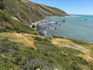
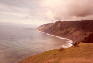
There were a few pictures from Day 1 that were missed, which shows the start of the first impasse and how rocky it was. Just before the impasse we were traversing along a bluff, but you could see in the distance, the cliffs and the shoreline with the tide coming in.
But we went forward at a quicken pace to make it half way through the impasse.
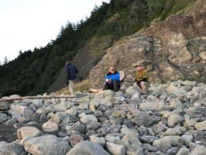
As you can see in the picture of Paul and I chatting it up at the mouth of the canyon we camped, there were plenty of rocks to contend with.
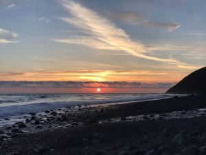
And as it became the norm, every evening we would all gravitate to watch the sun set before heading back to the campfire.
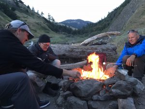
Cynthia and Keith hauled in a special treat for our first night to celebrate Sam’s birthday – a whole bottle of wine and items for making s’mores! What a treat!
Sleeping wasn’t hard either as we were on the beach, so the sound of crashing waves are continuous and for the first night, a babble brook too.
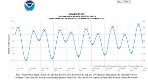
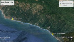
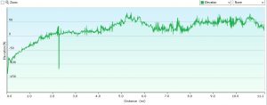
As you can see, our low tides were during the mid to late mornings. Since we were already 1/2 through the first impasse, we only had 2 more miles till we were safe, but the start of the 2nd impasse would be another 10 miles pass that. That was our goal for the day, to camp just before the 2nd impasse at Big Flat, so day 2 was to be our biggest day.
The next morning everyone woke up at different times. Paul was up early and killed some time making cairns on the beach. I was up shortly after that – not feeling too sore, but sure could feel it on the back and the calves.
We all traveled in twos. Paul and I , Keith and Cynthia, Sam and Tim. I always wanted to get a little head start in the morning as I was the newbie and the slowest. Today Paul and I started out about 9 a.m. Shortly there after Cynthia and Keith passed us by. at 10ish we were at the end of impasse 1. We all took a break here and enjoyed the creek, refilled our waters and took in the scenery. only about 10 miles to go!
The next 10 miles brought vastly different conditions. The morning started out calm and cool. After our first break, the winds picked up considerably. Although at our backs, it was a cold blast off the surface of the ocean and at times, pushed you along, weather you liked it or not. It was tricky crossing creeks, balancing yourself on a log crossing only to have the wind catch your back pack and almost toss you in the creek.
Our footing conditions changed quite a bite on this stretch also – from sand, to sand and rocks, to bouldering, and to hard pack trails. In the late morning and early afternoon we had a strong cold wind to our backs, with the only relief was to find a creek canyon or very large rock.
Walking in sand you loose about 20% efficiency with each step. Your foot sinks and slides with each step. At times, I would walk in someone else’s steps as it made it a bit easier. Other times you would search out rocks that were flat that would give you some traction, and when you were on a hard trail, you felt like you were superman.
By late afternoon we found ourselves on a grassy plateau. This turned out to be the beginning of Big Flat – and area which is the draining for Kings Peak (the highest point in the county) and the Kings Peak range. We found places to set up camp after a long days hike. Looking south, we could see the lights of Shelter Cove farther down the coast.
Lost Coast Hike – Day 1
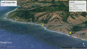
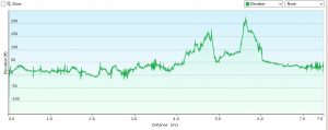
First Days Trek – 7.5 miles Click here for google earth kzm file.
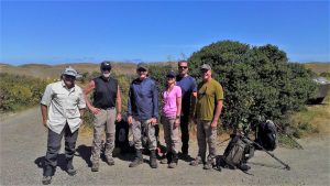
Monday morning we loaded our gear into our cars and headed to the lot at the south end of the trail at Black Sand Beach and parked. This is where we will come out on day 4. There was a shuttle driver we arranged to shuttle us two hrs north to the northern trail head.
Two hours later we were starting our four day hike with about 33 to 35 pounds on our back, sunny but cool weather with a good 15 mph tailwind. Our goal is to make it to the beginning of the first high tide 4 mile impasse zone, which was about 5 miles away.
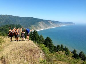
This hike is about 20% trail, with the rest of it is negotiating the beach and shoreline. The hike started on the beach, greeted by sea lions sun bathing on the beach, then turns into a small trail just above the beach, navigating thru some poison oak and gain some elevation and cliff like trails with breath taking views.
At our 5 mile mark, a decision was made to start the first impasse zone, but to camp at the halfway point. High tide was about an hour or so away, so we started out. We had to hustle as we were not sure. Luckily we all made it but it was close, as the last few hundred yards the tide was reaching the cliff side.
We settled in a remote canyon that we had to our self’s and after setting up camp, enjoyed the rest of the evening.
Lost Coast Hike – details coming….
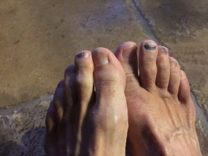
Will update with our group adventure, just getting all the pics together and finding some time to document the hike. Overall it was a great experience and a beautiful stretch of undeveloped California coast, only available by hiking it…. Came out of it with sore calves, tight shoulder muscles and a grin on my face. And even a week later, some toes that didn’t like one of the days and it still shows.
Lost Coast Hike… Jonesin for a Ride???
WTF, this isn’t a ride… Yup getting older and I’m confused. Why on earth do this? I use to be an avid camper, but just car/motorcycled camp. Never was interested in hikes into the back country carry all that gear you needed on your back, but was curious about it. Call it a bucket list item, but when I heard some co-workers doing this 4 day, 26 mile hike along the northern section of California’s Lost Cost from Mattole Point to Shelter Cover, I decided to try this type of hiking once.
The Lost Coast of California is a unique area. I only heard about it only recently even though I have traveled quite a bite of the state over the last 35 years. It is a section of coast undeveloped and a National Conservation Area which is only accessible by car to one small town in the middle (Shelter Cove, by foot, or a network of old logging roads. Two years ago Dean Tanji and I attempted to ride some of the logging roads only to turn back after awhile as it was early in the season the the roads were still slick with mud.
This time it will be on foot, along the remote rugged shoreline with two four mile stretches which you must time during low tide, as they are impassable during high tide. Click here for more info on the trail, or here for more general information.
You can also track us here live on my MapShare page (as I will be using my inReach device) or Spotwalla page. Our hike will start Monday morning June 4th and end Thursday late morning/early afternoon June 7th – if it goes as planned 🙂
